
Formerly known as the John Wayne Trail, the Palouse to Cascades Trail in Iron Horse State Park provides access to notable North Bend hikes, views of mountains and waterfalls, and a journey back into Washington’s history. Take in the wildlife and cross soaring bridges as you make a level traverse from Rattlesnake Lake to Change and Hall Creeks 5.5 miles to the east.
The Chicago, Milwaukee, St. Paul, and Pacific Railroad operated from 1908 until 1980, when it went bankrupt. The Department of Natural Resources acquired the railroad’s land, forming the 100-foot-wide Iron Horse State Park that traverses the state from east to west. The park contains more than 100 miles of trail from Cedar Falls to the Columbia River, all of it with a grade of 2.2% or less. The John Wayne Pioneer Wagons and Riders Association helped create the trail.
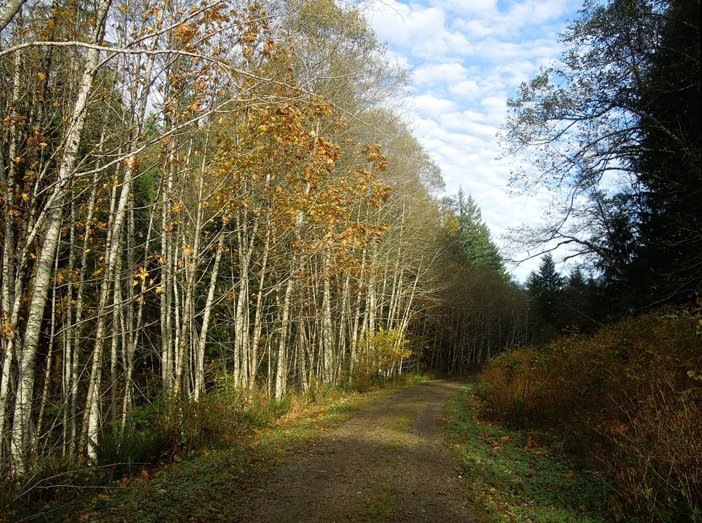
From the Iron Horse State Park parking area, find the signs for Iron Horse State Park, which will lead you to the broad state-crossing track. When you reach a sign indicating mileages to destinations including Twin Falls and McClellan Butte, you have reached the trail. Make a left to head east. The trail is lined by bigleaf maple, alder, western hemlock, Douglas fir, salmonberry, and thimbleberry. Falls colors can be spectacular. Squirrel and chipmunks squeak at you, and bald eagles and red-tailed hawks may circle overhead.
At 1 mile, cross over Boxley Creek with its outflow measuring station and pass the Cedar Butte trailhead on the right. Continue onward under the canopy, passing the falls of Boetzke Creek and then the abandoned train depot of Ragnar about 1 mile later. The trail still has the railroad’s mileposts, and many railroad artifacts are at Ragnar. Please feel free to enjoy these and take photographs, but leave them in place for other hikers to appreciate after you.
At 4.5 miles, pass the eastern terminus of the Twin Falls trail, on the left. Just 0.5 miles later, the unmarked trail to Mount Washington dips briefly between two large alders and begins its brutal ascent.
At 5.5 miles, reach the first of two towering trestles over Change and Hall Creeks. These former railroad bridges offer unsurpassed views of West Defiance Ridge, to the north, and Deception Crags, sheer rock walls used by climbers, lying to your south.
Palouse to Cascades Trail - Rattlesnake Lake

-
 Length
- 11.0 miles, roundtrip
-
 Elevation Gain
- 300 feet
-
 Highest Point
- 1,100 feet
The Palouse to Cascades Trail in Iron Horse State Park provides access to notable North Bend hikes, views of mountains and waterfalls, and a journey back into Washington’s history. Take in the wildlife and cross soaring bridges as you make a level traverse from Rattlesnake Lake to Change and Hall Creeks 5.5 miles to the east.
Continue reading
Hiking Palouse to Cascades Trail - Rattlesnake Lake
Map & Directions
 Trailhead
Before You Go
Parking Pass/Entry Fee
Discover PassWTA Pro Tip: Save a copy of our directions before you leave! App-based driving directions aren't always accurate and data connections may be unreliable as you drive to the trailhead.
Getting There
From Seattle, proceed east on I-90. Take exit 32, making a right on 434th Ave, which becomes Cedar Falls Road SE. Pass the Rattlesnake Lake parking area, coming to the entrance and parking area for Iron Horse State Park 3.0 miles from exit 32. The entrance will be on your left. There are 63 parking spots, including 2 for ADA access and 5 for trailers. There is a privy at the trailhead.


