Stunning DDT dump site off L.A. coast much bigger than scientists expected
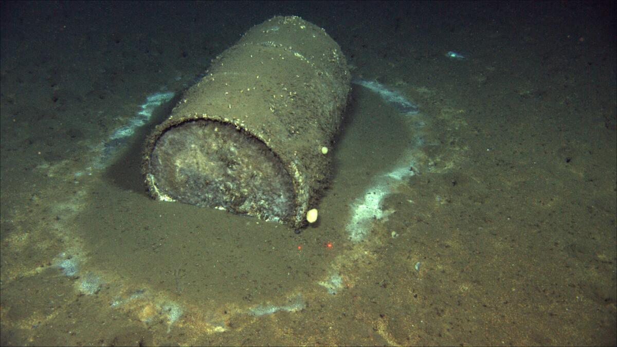
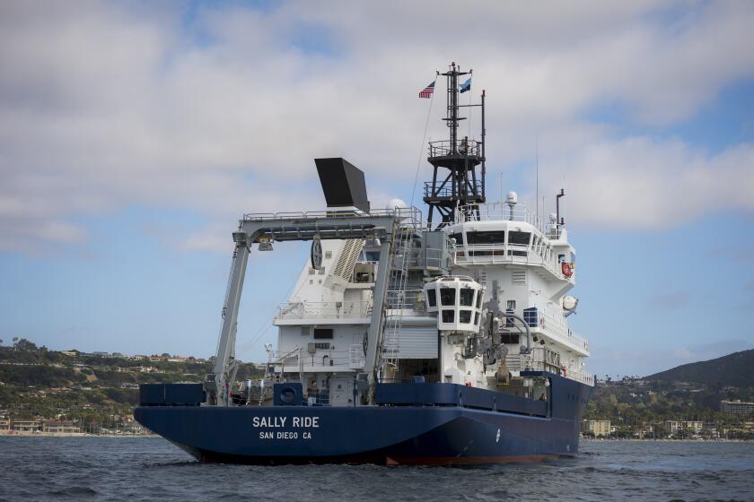
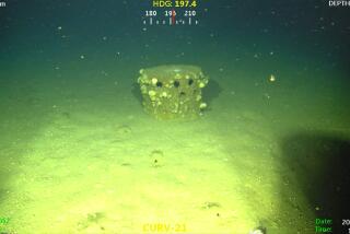
When the research vessel Sally Ride set sail for Santa Catalina Island to map an underwater graveyard of DDT waste barrels, its crew had high hopes of documenting for the first time just how many corroded containers littered the seafloor off the coast of Los Angeles.
But as the scientists on deck began interpreting sonar images gathered by two deep-sea robots, they were quickly overwhelmed. It was like trying to count stars in the Milky Way.
The dumpsite, it turned out, was much, much bigger than expected. After spending two weeks surveying a swath of seafloor larger than the city of San Francisco, the scientists could find no end to the dumping ground. They could’ve kept going in any direction, they said, and uncovered even more.
“I was pretty shocked that it just kept extending as far as it did,” said Eric Terrill of UC San Diego’s Scripps Institution of Oceanography, who led the mission of 31 scientists and crew members. “We couldn’t keep up with the flow of data coming in.”
Terrill shared these findings Monday in a U.S. congressional briefing led by Sen. Dianne Feinstein (D-Calif.), who has been pushing for action since The Times reported last fall that the nation’s largest DDT manufacturer once dumped its waste into the deep ocean. As many as half a million barrels could still be underwater today, according to old records and a recent UC Santa Barbara study that provided the first photos of this pollution bubbling 3,000 feet under the sea.
A new generation of scientists have uncovered barrels containing DDT, a toxic pesticide banned decades ago, dumped into the deep ocean.
“This mission confirms my worst fear: that possibly hundreds of thousands of barrels and DDT-laced sediment were dumped just 12 miles off our coast,” said Feinstein, who said she plans to ask the U.S. Justice Department to look into companies that may have illegally dumped waste into the ocean and whether they can be held accountable.
“I’m pleased the Biden administration shares my concern about this issue and took action quickly. It’s critical that this momentum continues,” she said. “We need everyone to come to the table with all the resources necessary to solve a problem of this size.”
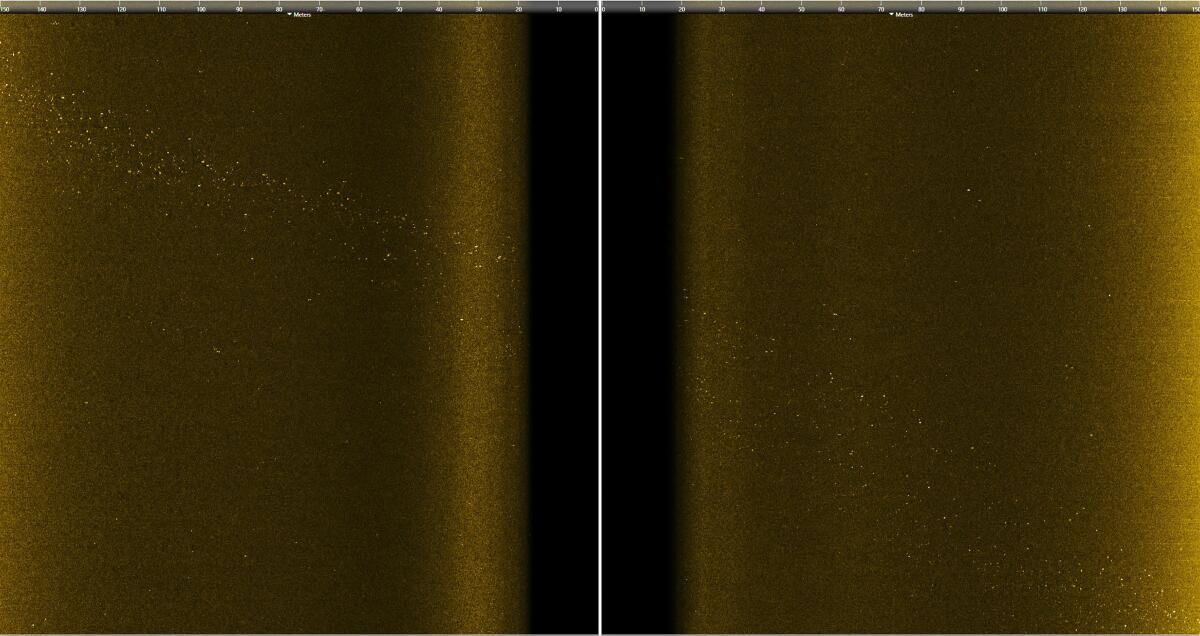
For Terrill, trying to count the barrels was like the episode of “I Love Lucy” in which Lucy gets a job in a chocolate factory and struggles to keep up with a speeding conveyor belt. But as his team pored over gigabytes and gigabytes of sonar data, they were finally able to identify at least 27,000 barrel-sized anomalies — and more than 100,000 total debris objects on the seafloor — with the help of some computer analysis.
The actual number of barrels could be even higher, he noted, because barrels that were half-buried by sediment, for example, may have been overlooked by the computer.
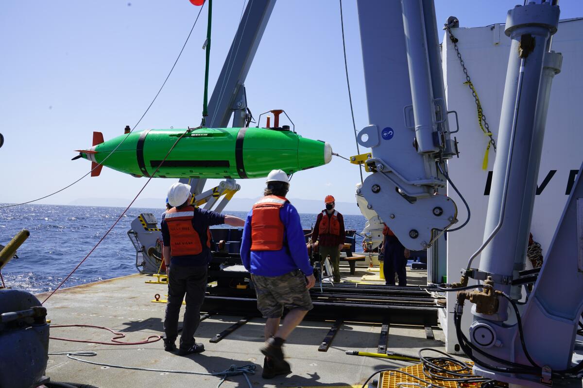
The two-week expedition, made possible by a unique partnership between Scripps and the National Oceanic and Atmospheric Administration’s Office of Marine and Aviation Operations, had deployed two high-tech robots that alternated scoping more than 36,000 acres of seafloor with high-resolution sonar: As one robot worked underwater, covering about 140 football fields per hour, the other recharged, offloaded its data and got recalibrated by scientists on deck.
A number of unexpected challenges, including stubborn winds and heavy rain, complicated the process. When Terrill realized his crew would not be able to manually count each individual data point that the robots were collecting from the seafloor, he called in “the big data guns”: Sophia Merrifield, a physical oceanographer and researcher in the Marine Physical Laboratory at Scripps.
A team of Scripps and NOAA researchers set sail to map the seafloor for DDT waste barrels dumped decades ago. As many as half a million of these barrels could still be underwater today.
Merrifield was astonished when Terrill sent her the first batch of sonar images. She jumped into action and started writing a computer algorithm that could sort through the immense amount of data while also accounting for the topography, the physics and the way sonar works in that part of the ocean.
“Think about the geology on the bottom, because that affects the acoustics,” she said. “We talked pretty constantly while [Terrill] was out there: What are ways that we could train an algorithm to detect these targets in an automated way?”
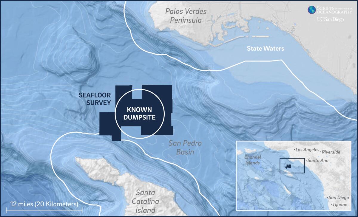
Another shock was the fact that the dumping was clearly not contained to one designated spot. Everywhere the crew surveyed, there were barrels, said Mark Gold, who has followed the DDT problem as a marine scientist since the 1990s and currently serves as Gov. Gavin Newsom’s deputy secretary for coastal and ocean policy.
“That to me was horrifying,” he said. “This is such a dark part of our environmental history.”
Once hailed as a wonder pesticide, DDT saved crops and combated malaria across the world. The U.S. banned its use in 1972, but the chemical, dichlorodiphenyltrichloroethane, is so stable it continues to poison the environment and move up the food chain.
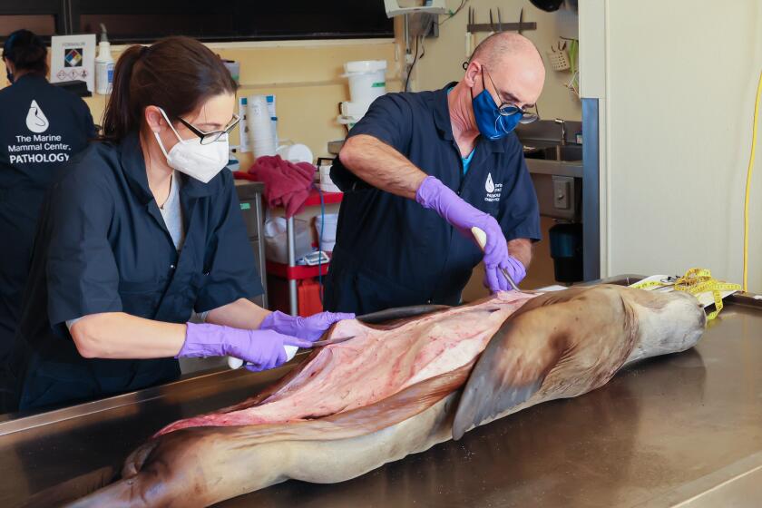
Significant amounts of DDT-related compounds are still accumulating today in Southern California dolphins, and a recent study linked the presence of these persistent chemicals to an aggressive cancer in sea lions.
Scientists found that sea lions exposed to DDT and other chemicals in the ocean are more likely to die from a herpes-induced cancer.
For decades, the nation’s largest DDT maker operated its plant on the border of Los Angeles and Torrance. A $140-million Superfund battle in the 1990s exposed the company’s disposal of toxic waste through sewage pipes that poured into the sea — but all the DDT manufacturing waste that was dumped into the deep ocean had drawn comparatively little attention.
Renewed outcry in recent months has focused on both the dumpsite and the Superfund site, which is still awaiting cleanup after more than 20 years of meetings and extensive studies.
Gold, who has been in numerous high-level meetings on this issue, said that both state and federal agencies, including the U.S. Environmental Protection Agency, have been following the Scripps-NOAA mapping efforts with great interest. Revisiting this history of deep-sea dumping has also raised questions of what other toxic chemicals and contaminants, in addition to DDT, could still be in the ocean today. Records show that numerous companies had dumped industrial waste in this area for several decades, beginning in the 1930s.
“I can’t tell you how thankful I am that NOAA and Scripps took this initiative to really get the ball rolling,” Gold said.
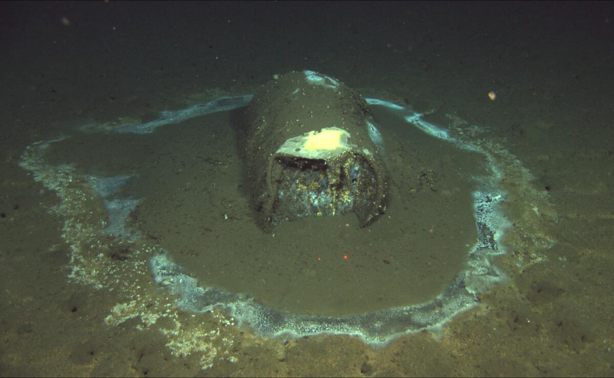
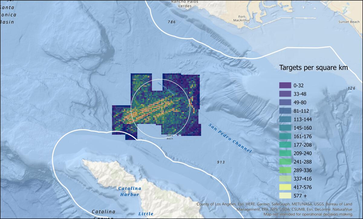
David Valentine, whose UC Santa Barbara research team first came across about 60 barrels on the seafloor while conducting a different research project, said the new mapping data revealed interesting hot spots — and “hot lines,” suggesting the path of a ship or barge as the dumping occurred — that will help scientists figure out where to focus further sediment and chemical studies.
“We’re starting to see the patterns of waste dumping that are going to guide us as we attempt to define the whole scope of this problem,” said Valentine, who has been inundated with calls and emails from fellow researchers, government officials and members of the public since The Times published its report in October.
It’s still unknown what’s inside any of these barrels — or how much this deep-sea pollution has been moving through the marine ecosystem, he said. “Right now, we’re seeing the tip of the iceberg.”
He felt a jumble of emotions as he examined the new data — maps of the seafloor covered with so many mysterious dots that hinted at just how widespread the dumping could be.
“The Southern California offshore dumping industry clearly got away with dumping wherever they wanted,” he said, “and that really makes me wonder: What else did they get away with?”

