A New River Innovation Challenge
Winning Submissions
“Story Sense is a central virtual platform, or ’hub’ that consolidates data, stories, photos, videos, experiences and more from experts and users. The platform shares this information in an accessible way to spark interest, foster community, and encourage stewardship.”
The jury chose this submission for its thoughtful design and narrative around the Don River in the Port Lands. The goal of the challenge was to share environmental data with park visitors and encourage them in conservation. This submission was particularly strong in helping people to learn about the new river system. It proposes to create a relationship with environmental data through stories. The team’s description of the proposal’s relationship to the future landscape, parks and rivers clearly envisioned the future.
“[WaterfrontHUNT is a] gamified digital application (app) that will enable your visitors to explore details of the Port Lands on mobile devices via an augmented reality environment while they navigate the physical park.”
The jury noted this submission took a playful approach to the challenge and included some social and economic factors that contribute to the history and causes of climate change.
“[MiDON is] a digital mobile game that motivates families and friends to return to the same water monitoring station(s). Images they submit to earn points towards badges will be used with real-time data to predict future ecosystem changes and climate impacts on the new Port Lands.”
The jury was impressed with this team’s cross-disciplinary experience and the strong game design proposal. They also liked the proposal’s inclusion of citizen science and mental health and wellness.
A New River Innovation Challenge, supported by the RBC Tech For Nature Grant, asked data scientists and designers to propose ideas of how we could collect, interpret and share the environmental data from the new river system in the Port Lands to educate visitors and motivate conservation in the wider community.
We received 10 submissions from multidisciplinary teams. Thank you to everyone who participated in the challenge!
About the Challenge
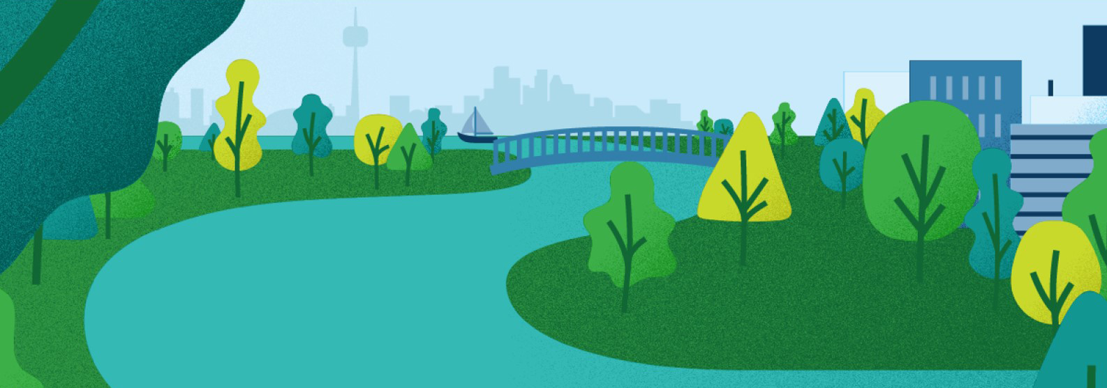
Waterfront Toronto is building a new river in downtown Toronto and we want you to be a part of it.
As you may have heard, Waterfront Toronto is in the middle of building a new mouth for the Don River. The $1.25 Billion project, known as the Port Lands Flood Protection Project (PLFP), will protect 240 hectares of downtown Toronto from flooding, in addition to restoring important ecological areas to support diverse fish and wildlife.
In order to track progress and measure outcomes of this important work, Waterfront Toronto and our partners have been working to capture a wide array of environmental data on the new river mouth and the natural systems that support it. Much of this information will be used by scientists and engineers within the PLFP project and to inform potential future projects down the road. However, Waterfront Toronto sees other potential uses for this data, and we want you to help us come up with innovative ways to use it.
The question is: How do we collect, interpret and share the environmental data from these new ecosystems to educate visitors and motivate conservation in the wider community?
In this challenge, we invite data scientists and designers to develop creative, compelling, and innovative ways to communicate this scientific information to the public. Our intent is to leverage our partnerships and the data we generate to foster innovation in science communication. The outcome will be to stimulate interest and knowledge about how climate positive urban development interacts with natural systems; to share this information with the people who will use and enjoy the river valley; and to encourage stewardship of the river’s water, wildlife and habitats.
What are we looking for?
Proposals that use a physical and/or digital platform to convey environmental data from the PLFP project to visitors and community members in a way that promotes environmental stewardship and conservation.
Some examples include:
- https://www.ontarioparks.com/parksblog/citizen-science-apps/
- https://www.nationalgeographic.org/encyclopedia/citizen-science/
Who should participate?
This challenge encourages multi-disciplinary collaboration and is open to a wide variety of experts including designers, scientists, engineers, computer scientists and others from private, public or nonprofit sectors. We encourage corporate applicants to consider opportunities to include students or young professionals on their team.
Opportunity
$10,000 award for the top three proposals and a $30,000 honorarium for the top team to advance their proposed design.
The deadline to submit a proposal has been extended to May 30, 2021.
Download an overview of the challenge to share with potential team mates here. A plain text version of this document is available here.
Challenge Brief: this document contains all information about the challenge, including context and submission requirements:
- Challenge Brief
- Challenge Brief, Plain Text Version
- Appendix A – PLFP Data Collection
- Appendix B – Contest Rules
- Appendix C – Data Privacy Guidance
- Baseline Surface Water Quality Monitoring Plan
- Submitted Questions and Answers
Access data: data.trca.ca
Participation
For National Engineering Month, we planned a few online presentations and live Q & As with members of the Port Lands Flood Protection project team. They talked about what they do, what they’d like to know about the future river’s performance and answered questions about this massive infrastructure project.
Q & A Sessions:
Earthworks and Geotechnical
Meggen Janes, Former Director Soil and Groundwater Management, Waterfront Toronto & Onur Kutlu, Project Engineer, Geosyntec Consultants, Inc.
Park Design
Shelley Charles, Elder, Lead Consultant, MinoKamik Collective & Emily Mueller De Celis, Partner, Michael Van Valkenburgh Associations
Water and Aquatic Species
Jonathon Kusa, President & CEO, & Marty Melchior, Principal Ecologist & Fisheries Biologist, Interfluve & Angela Wallace, Senior Project Manager, Aquatic Monitoring and Management, Toronto and Region Conservation Authority
The deadline to submit questions has passed. Here is a document containing all questions that were submitted and answers to them.
About the Port Lands
Explore this website to learn more about different aspects of the Port Lands Flood Protection Project. Here are a few useful links to get you started:
- Interactive Map (works best on a desktop)
- Why This Matters
- Frequently Asked Questions
- Nature and Parks in the Port Lands
This video also gives a good overview of what we’re building and why:
Construction is progressing quickly. We’ve excavated more than 400,000 cubic metres of soil from the future river valley. This video shows a drone flight over the site from December. It identifies points of interest and major streets of the future Villiers Island.
How are we restoring the Don River’s natural flood-protection capacity?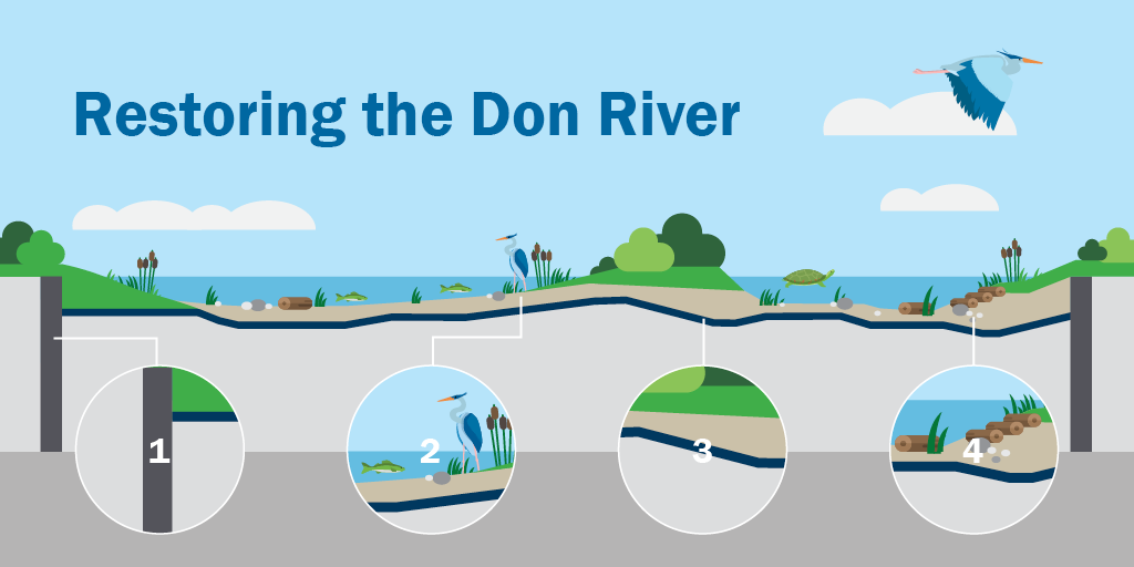
- Stabilizing perimeter walls
- Adaptive landscapes
- A barrier to protect the river
- Foundations for a thriving ecosystem, such as plantings to create habitat
New River Innovation Challenge Partners

The Toronto and Region Conservation Authority (TRCA) works with its partners to ensure that Toronto and Region is built upon a natural foundation of healthy rivers and shorelines, greenspace and biodiversity, and sustainable communities. With more than 60 years of practical experience in protecting the environment, educating young people, and creating resilient communities, TRCA works with government, businesses, local organizations and individuals to build a greener, cleaner, healthier place to live.
TRCA is one of 36 conservation authorities in Ontario. Its jurisdiction includes Canada’s largest urban centre, nine watersheds and the Lake Ontario shoreline from Mississauga to Ajax. Working with the regional municipalities of York, Durham, Peel, the City of Toronto, TRCA protects and restores the natural environment and the fundamental ecological services that our environment provides.
![]()
This competition is made possible through RBC’s Tech for Nature Grant Program. The Tech for Nature Grant Program brings together charitable organizations and technology experts to build multi-partner coalitions to address and help solve our shared environmental challenges.