
Aerial Photo Scanning Service (Fee-based)
 The Map Library’s historic print aerial photographs can be scanned for patrons who are unable to visit the library to do this research in person. Details on the fees for this service are listed below.
Please use the Wisconsin Aerial Photography Catalog to see the library’s collection holdings before making a request via the form.
REQUEST DIGITAL VERSIONS OF HISTORIC AERIAL PHOTOS (CLICK HERE)
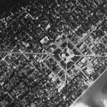
If you are looking for 1937-41 imagery, you can access and download individual images form the entire statewide digital collection for free from: WHAIFinder: Wisconsin Historic Aerial Image Finder
Fee-based Service
External Customer (Payment will be made by an individual, private entity, non-profit, or governmental organization other than the UW or State of WI.) $10.00 per photo (sales tax will be added for WI)
Internal Customer (Payment will be made by a University of Wisconsin system department, or WI state agency. Tax exempt number may be required.) $7.00 per photo – with invoices sent for requests of 4 images (or more) only. (sales tax may be added for WI)
Customer Agreement:
Scale information for all Map Library aerial photograph collections is available from the WI Aerial Photography Photography. The Map Library cannot guarantee that the scales/resolutions of scanned imagery will necessarily meet all needs. Image scans are limited in resolution by the height of the plane that originally took the photo (as indicated in the scale information.) Keep in mind that the bulk of the library’s photo collections were taken by the USDA to estimate crop acreage over large areas. Seeing very small features, buildings, driveways, etc. may be difficult. By requesting digital scans, users are made aware of these terms and will not be refunded for images they ultimately determine are not detailed enough for their purposes.
Notification Concerning Public Access to the Library’s Photo Collections and Relevant Copyright Restrictions:
Public Access to the Library’s Photo Collection:
This scanning service is offered as a convenience for patrons who prefer to remotely request digital scans of the library’s historic aerial photos. It should be noted that the Robinson Map Library is open to the public, and the entire aerial photograph collection can be accessed in-person, by anyone, during the library’s hours of operation. Patrons do not need to be affiliated with UW-Madison to view, copy, or scan items from the aerial photograph collection. Scanners are available within the library free of charge.
Please see our location and hours of operation here.
Notice of Copyright Restrictions:
While the vast majority of the aerial photography in the Robinson Map Library’s archive are in the public domain, there are several sets of photos we cannot make available in digital format due to copyright restrictions.